Storm No. 1 Brings Heavy Rainfall to Northeastern Vietnam and Thanh Hóa Province
The National Center for Hydro-Meteorological Forecasting has issued an urgent warning regarding Storm No. 1, which is moving faster than initially predicted. Residents and authorities in the Northeastern region and Thanh Hóa Province are advised to prepare for the risk of thunderstorms, tornadoes, and strong winds both before and during the storm's landfall.
Detailed Information About Storm No. 1
According to the latest updates from the National Center for Hydro-Meteorological Forecasting, Storm No. 1 (international name: Talas) formed over the East Sea on the morning of August 25. As of the current time, the storm is moving in a west-northwest direction at a speed of approximately 15-20 km/h.
| Parameter | Value |
|---|---|
| Storm center location | Approximately 18.0°N latitude; 111.0°E longitude |
| Wind intensity | Level 8-9, with gusts up to level 12 |
| Radius of strong winds | Approximately 200km |
| Direction of movement | West-northwest |
Impact of the Storm
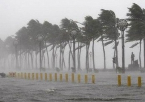
Storm No. 1 has already caused localized heavy rainfall in many areas of Northeastern Vietnam and Thanh Hóa Province. Rainfall in these areas is expected to reach 100-200mm, with some locations exceeding 250mm in the next 24 hours.
The East Sea is experiencing strong winds at levels 6-7, with areas near the storm center reaching levels 8-9 and gusts up to level 12. Sea conditions are extremely rough. Coastal areas in the North and Central regions are at high risk of waves 3-5m high, while areas near the storm center may experience waves 6-8m high.
| Region | Level of Impact | Expected Rainfall (mm) |
|---|---|---|
| Quang Ninh, Hai Phong | Heavy impact | 150-250 |
| Thai Binh, Nam Dinh | Moderate impact | 100-180 |
| Thanh Hoa | Heavy impact | 180-250 |
| Nghe An | Light impact | 80-150 |
Preventive Measures
In response to the complex development of the storm, the Steering Committees for Natural Disaster Prevention and Control and Search and Rescue of provinces and cities have issued urgent directives on storm prevention measures.
- Organize counting, inspection, arrangement, and evacuation of residents in low-lying areas, coastal areas, and areas at risk of landslides and flash floods to safe locations
- Direct vessels operating at sea to find safe shelter and avoid entering the storm center area
- Prepare contingency plans for potential emergency situations
- Strengthen monitoring and inspection of critical infrastructure such as dams, dykes, and irrigation systems
- Ensure readiness of rescue forces and equipment for emergency response
- Suspend outdoor activities, especially in areas prone to landslides and flash floods
- Stockpile essential supplies including food, clean water, medicine, and emergency equipment
Weather Forecast for the Coming Period
Over the next 24-48 hours, Storm No. 1 is expected to continue moving in a west-northwest direction at approximately 15-20 km per hour. By the morning of August 27, the storm's center is projected to be over the sea area from Ha Tinh to Quang Nam. Its intensity may decrease to levels 7-8, with gusts up to level 10.
Due to the storm's influence, the area from Thanh Hoa to Thua Thien Hue will experience moderate to heavy rainfall, with some locations receiving extremely heavy rainfall. Provinces from Quang Binh to Thua Thien Hue face a high risk of flash floods and landslides in low-lying areas and along rivers and streams.
Conclusion
Storm No. 1, moving faster than initially forecast, is causing significant impacts to the Northeastern region and Thanh Hóa Province. Residents and authorities should proactively implement preventive measures to minimize damage caused by the storm. Regular monitoring of updates from the National Center for Hydro-Meteorological Forecasting is essential to stay informed about the storm's latest developments.
As climate patterns become increasingly unpredictable, the importance of accurate weather forecasting and effective disaster preparedness cannot be overstated. The advanced meteorological technologies employed by the National Center for Hydro-Meteorological Forecasting play a crucial role in safeguarding lives and property during extreme weather events.
#StormNo1 #NortheasternVietnam #ThanhHoa #WeatherForecast #DisasterPrevention